Civgraph aspires to bring together a wide range of information of all kinds: elections and the candidates; censuses and statistics; deprivation measures; opinion polls; geology and terrain; Parliamentary debates; how politicians voted; archives and scanned books; and political and administrative boundaries. Most of this already exists somewhere public, scattered across portals, archives and old reports, in formats that cannot be easily compared, with some of it not online at all before.
Civgraph includes multiple layers, such as the original sources, kept whole and verbatim, as texts, maps and tables, scanned or digital; the data derived from them in cleaned, labelled and linked formats, encompassing people, places, geographies and statistics; and tools which take that data as an input and turn it into something usable. The tools are part of the project, not an extension of it.
Some of those tools exist today. The longer aim is that the whole linked record can be queried and analysed by anyone, and that any practically possible tool can be built on it.
The boundaries and geography are the backbone. Wards, districts, constituencies and census geographies are redrawn every 10-15 years. Nothing recorded about these geographies can be read across decades unless the boundaries themselves exist in digital form. Most of the historic ones didn’t.
Civgraph is a home for the digitising, scanning and research of volunteer contributors to coexist alongside the original sources, always clearly distinguished from them. Many of our maps are scanned and digitised by our volunteers where no official digitised version existed, mirrored and backed up for the years to come, and made available in full.
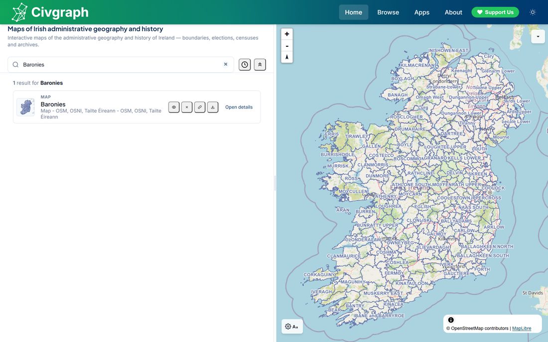
Its scope is the island of Ireland, its seas and outlying islands, and openly available civic data about it, whether that comes from governments and public bodies or from private organisations, groups and individuals. It is meant as a factual work of reference on Irish civic life, released under open licences and built to be easy for anyone to use.
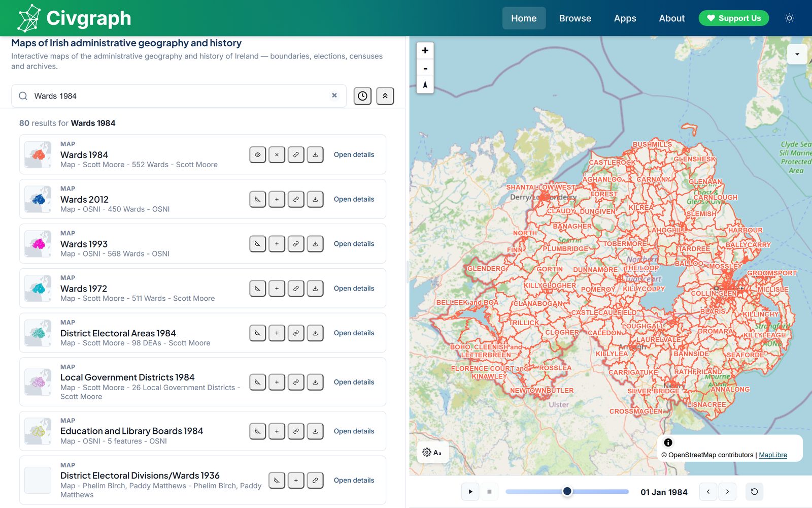
Civgraph took its original inspiration from Spatial NI , the service run by Ordnance Survey of Northern Ireland (OSNI). Spatial NI publishes maps produced by public bodies, which excludes maps made by citizens, so the 1984 council ward map we digitised could not appear there. On Civgraph they sit alongside everything else.
That breadth is the point. The catalogue draws on 58 organisations north and south, and every layer is credited to the body that made it:
- Northern Ireland government and agenciesOSNI and Land & Property Services, NISRA, DAERA, the Northern Ireland Environment Agency, the Geological Survey of Northern Ireland, the Tellus survey, the Department for Infrastructure, the Department for Communities, the Police Service of Northern Ireland, Translink, NI Water and the Department of Health.
- Republic of Ireland government and agenciesTailte Éireann, the Central Statistics Office, Geological Survey Ireland, Transport Infrastructure Ireland, the Office of Public Works, the National Parks and Wildlife Service, the Environmental Protection Agency, and the Department of Housing, Local Government and Heritage.
- Local authorities, north and southDún Laoghaire-Rathdown, Dublin City, Fingal, South Dublin, Cork City and Monaghan county councils; Mid Ulster District Council; and Armagh City, Banbridge and Craigavon Borough Council.
- Boundary and electoral bodiesthe Local Government Boundaries Commissioner for Northern Ireland, the Boundary Commission for Northern Ireland, the Electoral Office for Northern Ireland and the Electoral Commission.
- Open data portalsOpen Data NI and data.gov.ie, through which much of the above is published.
- Independent and community projectsOpenStreetMap, parlconst.org, the Database of British and Irish Hills, Ulster Wildlife and the National Inventory of Architectural Heritage.
- Scientific and internationalCopernicus and the European Space Agency, Eurostat, the British Geological Survey, OpenTopography, the International Hydrographic Organization and Trinity College Dublin.
- Volunteersindividual contributors, credited by name on the maps they made, among them Phelim Birch, Paddy Matthews and Scott Moore.
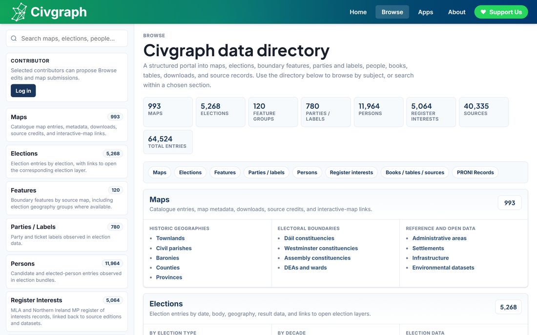
What's in Civgraph
| Maps | 795 | public map layers, from 1,031 catalogue entries and 1,139 rendered layers |
|---|---|---|
| Elections | 8,499 | constituency contests across 960 elections, holding 46,128 candidacies |
| People | 19,885 | candidates and elected representatives, linked to the contests they stood in |
| Books | 67 | scanned volumes, including Parliament of Northern Ireland debates and Acts |
| Sources | 41,222 | catalogued source records, each with its provenance |
| Graph | 226,974 | entities and 1.29 million statements linking them |
How we made the boundaries
This is where Civgraph started, and it is still the bulk of the work. The 1993 and 2012 Northern Ireland ward maps were digitised and publicly available; the 1984 and 1971 ones were not, and neither were most boundary maps between 1920 and 1971. We asked the Ordnance Survey of Northern Ireland and they gave us scanned maps of local government boundaries going back to 1973, which they agreed to publish on Open Data NI. But a scan is an image, not a boundary: it cannot be zoomed, queried or compared. So we learned QGIS and did it ourselves.
Digitising one historic boundary map goes roughly like this:
- Start from what already exists. Some boundaries do not change between reviews. Several 1992 wards were unchanged from 1985, so they can be copied across from a later digital map rather than redrawn.
- Build from townlands where you can. Many historic wards are simply stacks of townlands, and Tailte Éireann and OSNI both publish digital townland boundaries. Where a ward is a whole number of townlands, the work becomes a jigsaw rather than a drawing exercise.
- Borrow edges from other geographies. Historic parliamentary constituency maps, such as those at parlconst.org, line up with some ward edges exactly, so those edges can be reused instead of traced.
- Digitise the rest by hand. What is left gets drawn in QGIS against the scan, following streets, fences, field boundaries and rail lines, which is what the original surveyors used too.
- Check every boundary against the scan. The finished layer is compared back to the scanned map sheet by sheet. This is the slow part, and the part that decides whether the result is trustworthy.
The 1984 ward map took months of evenings this way. The same method has since been applied to Republic of Ireland electoral divisions, and it is the work we most need help with. Alongside it we scan books from libraries: first boundary commissioners' reports explaining why boundaries were drawn where they were, then other volumes that weren't online and could legally be scanned and redistributed.
Why this matters
Wards, DEAs, councils, constituencies, settlements and census data zones all have data attached to them: census and demographic statistics, election results, deprivation indicators, who stood and who won, public spending, geology, rivers, and distance to a hospital or a railway station.
The obstacle to using any of it together is that the boundaries move. Census geographies change, wards and constituencies are redrawn every ten to fifteen years, and almost nothing can be compared like-for-like across decades unless you know precisely which boundaries were in force when. That's the gap Civgraph fills.
Where this is going
The maps are the means, not the end. Civgraph exists so that the data attached to Irish places can be compared across time by anyone who wants to, and not only by people who have GIS software and the patience to reconcile forty years of boundary changes before they can start.
Almost everything recorded about a place is recorded against an area. Census and demographic statistics, election results and transfers, deprivation indicators, who stood and who won, what representatives said in the chamber and how they voted, public spending, opinion polls, and the physical geography underneath all of it, from rivers and basins to how far it is to a hospital or a railway station. Each of these is published somewhere already. Taken together, across decades, they are close to unusable, because the areas they are attached to keep being redrawn. Holding the boundaries steady is what makes the rest comparable, and that is what the catalogue, the election records, the person index and the source archive are for.
The part still to be built is the analysis layer. The intention is a section of the site where you choose some areas and a period, combine variables across them, and get back a chart or a map in which every figure can be traced to the record it came from. No GIS software, no reconciling census geographies by hand, and nothing taken on trust. Where a comparison is unsafe because the underlying geography changed, it should say so rather than quietly averaging across the join.
Some analysis of this kind has already been done here by hand rather than by the site: projections of support for Irish unity from 1989 to 2025, what a fifty per cent plus one result would actually require, and how that support is distributed geographically. That is precisely the sort of work the site should let other people do for themselves, on whatever questions they care about. The constitutional future of Ireland is only the most obvious of them, and it is not the only one that turns on being able to compare like with like over time.
None of this is finished and none of it is promised by a date. It is what the archive is being assembled for.
Provenance and licensing
We aim to record where every item came from. That's the discipline Civgraph runs on, and automated checks enforce it rather than leaving it to memory.
- Open Government Licence: OSNI and NISRA material in the north, Tailte Éireann and Central Statistics Office material in the south, and PRONI eCatalogue records.
- Crown copyright: Parliament of Northern Ireland debates and Acts, scanned from physical copies. No licence is asserted over the underlying material.
- CC BY-SA 4.0 and ODbL: ElectionsNI, the ODI Belfast / NICVA open data project. Civgraph's STV count animation derives from their work, and they and the Electoral Office for Northern Ireland are credited accordingly.
- CC BY 4.0: the Database of British and Irish Hills.
- Contributed maps: credited to their creators by name, with the original's rights recorded separately from the digitisation.
Our data is also mirrored to the Internet Archive, so it stays available independently of this site. Civgraph holds a mirror of all data from Open Data NI and the Open Data Portal Ireland. Where a rights position hasn't been established, we record it as unestablished and the material stays unpublished until it's settled.
Place names
Numerous place names in Northern Ireland are politically contested. These include the town of Craigavon, named after the baronial title of the former Prime Minister of Northern Ireland; Royal Hillsborough, which has acquired a 'Royal' prefix in recent years; the name of Northern Ireland itself, which did not exist in law before the 1920s; various streets, settlements and places named after British royal or state figures, such as Chichester Street and Cromwell Street in Belfast; historic wards and DEAs carrying names such as "Royal Portrush" and "Victoria"; and the city, county, council district and historic constituencies variably known as Derry or Londonderry.
The same is true south of the border, where many names were changed after independence: Queen's County and King's County became Laois and Offaly, Maryborough became Portlaoise, Kingstown became Dún Laoghaire and Queenstown became Cobh. Civgraph holds maps from both before and after those changes, so both forms appear in the data.
Civgraph seeks, in part, to record and document the administrative history of Ireland, primarily through maps. So all place names used in the datasets reflect the names used in the original sources. The pre-1973 county borough is recorded as "Londonderry", while the post-1973 district council used "Derry" from the 1980s onwards. NISRA, which compiles settlement population statistics, has referred to "Derry City" since at least 2011, and also to "County Londonderry", and these are reflected in the settlement and county maps.
The map layers do not currently support the display of place names or other information in the Irish or Ulster-Scots languages. We would like to implement this, and the only barrier is finding the time. If you have any queries about this, please get in touch.
Contributing
Maps, scans, corrections and sources are all welcome. Contributed maps are credited to their creators, and our submission route records the contributor alongside the original's rights holder.
Civgraph is built by a small group of volunteers and the work carries on regardless, but we're always looking for people to join, and you can contribute as much or as little as you want. There's no need to know your way around GIS.
You can contribute by:
- Scanning historic maps, books and records, be they openly-licenced or under expired copyright
- Digitising historic maps using tools such as QGIS, so they can be made available on the site
- Finding and reporting bugs on the site, and any errors, mistakes or inaccuracies you find on the site, including in the data and maps
- Finding and cleaning openly-available data you find online
- Helping us with programming and developing the website and the project
- Supporting us with the financial costs of running and building the project
Map submissions go through an approved-contributor list, so the submission form only opens once an email address has been given access. If you would like to submit a map, email scott@civgraph.net and we'll set you up.
Projects you could take on
These are concrete pieces of work that would each make a real difference, and none of them are started. Phelim Birch, who has contributed a large part of the catalogue already, has offered to guide anyone who wants to take one on.
- Historic Local Electoral Area digitisationTurning the legal documents that define Local Electoral Area boundaries in the Republic - most of them freely available online - into digital boundaries, so local election results can be mapped to the areas that were actually in use. No scanned LEA maps exist, so the boundaries have to be built from the statutory descriptions.
- Historic town and urban district digitisationThe town commissioners and urban districts that governed Irish towns until town councils were abolished in 2014, none of which exist as digital boundaries.
- 19th century Electoral Division mapsCivgraph's electoral divisions currently start in 1911. Extending them back into the nineteenth century would connect the census and poor law records that use them.
If one of these appeals, email scott@civgraph.net and we'll put you in touch and get you started.
Spotted something wrong?
You do not need to be able to use GIS software, and you do not need a corrected map. If you know a boundary, a date, a name or a result is wrong, tell us what it should be and where you know it from, and we'll check it and credit you if you'd like.
To learn more, contact scott@civgraph.net.
Contributors
- Scott Moore - website development, research and digitisation of NI maps, collecting and aggregating open-licenced online data
- Phelim Birch - research and digitisation of ROI maps
- Paddy Matthews - research and digitisation of ROI maps
- Alessio Coci - website development (user interface, user experience)